Summary
| DATE | 01/04/1853 |
| ORIGIN TIME | 22:45:00 UTC |
| LOCATION | 49.150 -1.700 |
| DEPTH | 21.0 km |
| MAGNITUDE | 5.2 ML |
| LOCALITY | COUTANCES |
| DATE | 01/04/1853 |
| ORIGIN TIME | 22:45:00 UTC |
| LOCATION | 49.150 -1.700 |
| DEPTH | 21.0 km |
| MAGNITUDE | 5.2 ML |
| LOCALITY | COUTANCES |
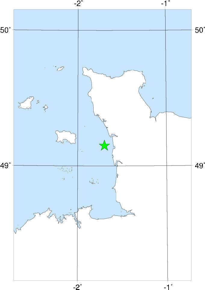

The epicentre of this earthquake was on the west side of the Cherbourg peninsula, near Coutances. As well as being strongly felt in the Channel Islands, it was also felt on the south coast of England, especially around Bournemouth. At Coutances the spire of the cathedral was damaged and there was damage to plaster in Jersey.
There is significant disagreement between some interpretations of this event, particularly Ambraseys (1985) and BRGM, who differ in intensity assignments for some places in France by as much as three degrees.
Sources: Neilson et al (1984b), Ambraseys (1985), BRGM.