Are yesterday's earthquakes tomorrow's disasters?
| Magnitude | UK earthquake frequency |
|---|---|
| 5 | 1 every 20 years |
| 4 | 1 every 3–4 years |
| 3 | 3 each year |
| 2 | 25 each year |
| 1 | 100s each year |
Earthquakes in historical times that shook empty hillsides have the potential to repeat in the future as humanitarian disasters, where cities have grown up unaware of the hazard.
Unearthing the records of past earthquakes through historical and geological research allows us to better understand the risk to today's cities.
Deadly combination
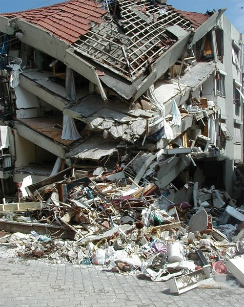
The catastrophic earthquake that struck Haiti in January 2010 was at least the third deadliest earthquake in human history, and was widely described at the time as the 'perfect storm' earthquake.
Every possible bad factor was there. The earthquake was large, it was shallow, it was close to a major city, and that city was badly built, full of weak structures that collapsed at once, burying and killing the inhabitants.
But there was one further factor: it seems that no-one in Haiti even knew that there was an earthquake problem. Despite the fact that Port-au-Prince is next to a major plate boundary fault, because that fault had not moved in centuries, knowledge of the last destructive earthquake was confined to dusty archives.
Learning from the past
In countries that experience earthquakes regularly, people at least know that they should be prepared. But where the last earthquake is beyond living memory, whole populations may be unaware of the threat that stalks them.
The first step in dealing with a problem is understanding it. In the case of earthquakes, that means knowing where earthquakes have happened in the past, and which will inevitably repeat themselves at some point in the future.
In addition, by understanding the geological structures that cause those earthquakes, one can extrapolate along the lines of major faults, and identify other places where similar earthquakes could strike.
This year a new online resource for the study of historical earthquakes was completed by a team of seismologists and historians led by National Institute of Geophysics and Volcanology (INGV) in Milan and including BGS in the UK. The Archive of Historical Earthquake Data (AHEAD) contains data on all the most significant damaging historical earthquakes in Europe, accessible via an easy web interface. This provides valuable data for planners, insurers, scientists and anyone with an interest in past earthquakes. The next stage will be to expand this to global coverage, in the frame of the Global Earthquake Model (GEM) project.
These new databases will provide an instantly accessible guide to danger spots for major earthquakes.
Historians can help save lives!
It is easy to think of history as purely an ivory-tower, academic research area; interesting, but not relevant. This is not the case at all, and in recent years, professional historians have been called on to work alongside seismologists in uncovering the record of past earthquakes; work that helps us to quantify the risk from future earthquakes.
See also UK Macroseismic Database.
Earthquake rates remain constant
It is generally believed, and confirmed by all available data, that the rate at which earthquakes occur over the long term is constant. Indeed, it would be amazing if this was not so, since the ultimate source of the energy released in earthquakes, heat generated deep within the earth's mantle, is hardly likely to fluctuate significantly.
What is changing, is human society. Population is increasing worldwide, and becoming more and more urbanised. But an urban population is a more vulnerable population.
Traditional pastoralists are not much at risk from earthquakes, but economic migrants living in poorly-constructed shanty towns are highly vulnerable. Thus, even if the rate of earthquakes stays the same, the rate of earthquake disasters is likely to increase.
See also Is earthquake activity increasing?
Increasing urbanisation

The 2010 earthquake in Haiti killed nearly a quarter of a million people. Contrast that with the previous similar earthquake in 1770, when Port-au-Prince was a small town; total deaths were perhaps around 300, a thousand times less.
And prior to 1770, some time before European colonisation, the native population, living in lightly-constructed huts rather than stone buildings would have been immune to earthquake damage.
So what was just an earthquake in the historical period, can be a disaster when it repeats itself today.
Examples from Vancouver and Seattle
Although from the configuration of the earth's tectonic plates one could infer earthquake hazard in this area, and generally non-damaging earthquakes are common, it was only relatively recently that the scale of the largest possible earthquake that could affect these cities was realised.
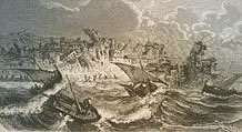
The last major earthquake in the Pacific Northwest actually occurred in January 1700, well before European settlers arrived. Japanese historians discovered records of a tsunami that didn't seem to be associated with any local earthquake; calculations based on the descriptions of the wave arrivals showed that it must have travelled across the ocean following a massive magnitude 9 earthquake on the North American coast.
The native inhabitants of the region had no written history, but it was found from folklore research that an oral tradition of a great disruptive event could be traced back to about this period.
Furthermore, geomorphologists working in Washington state were able to find indications of recent changes in land level, including drowned vegetation, that could be dated back to around 1700.
The final link in the chain was provided by studies of the sea floor off the coast, which discovered submarine landslides that indicated not just a magnitude 9 earthquake in 1700, but a chain of previous similar events stretching back over thousands of years.
So thanks to these multidisciplinary studies, planners in Washington and British Columbia know what the hazards are. It is quite likely that the next magnitude 9 earthquake in the region is still several hundred years away, but there is no guarantee of this, and it's better to be prepared.
Lessons for the UK
One might think that this is not an issue in countries like the UK, but although the scale of the problem is far smaller, similar issues arise. Most people have no idea of the earthquake history of their country, and have no knowledge of past earthquakes beyond the scope of living memory. And the same issue of increased exposure to earthquakes applies just as much to Britain as to the rest of the world.
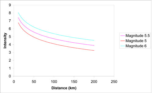
One of the strongest earthquakes to have affected Britain occurred on 6 April 1580; the magnitude, estimated from the size of the area shaken, was about 5.5, and the epicentre was in the Dover Straits. Although it was some distance away, London was quite strongly affected, probably because the soft Thames clays are more susceptible to being shaken. Nor was this an isolated event; a very similar earthquake occurred in 1382, which also caused damage in London.
What has happened twice can happen a third time; what will be the effects on the London of today? In 1580, two people in London were killed. Modern London has about 40 times as many people living in it and while a comparable earthquake would certainly not cause a disaster on an international scale, the level of shaking would come as an unpleasant shock in a country that tends to think of itself as immune from earthquakes.
See also The case for large (M >7) earthquakes felt in the UK in historical times
Further information
Contact Brian Baptie for further information.

- A Comparison of the Folkestone and Market Rasen Earthquakes
- Seismogenesis and State of Stress in the UK
- Monitoring Volcanic Eruptions Using Interferometry
- Particular events
- Are yesterday's earthquakes tomorrow's disasters?
- Creating 'virtual seismometers' deep inside the Earth
- Is earthquake activity related to the Moon or Sun?
- Is earthquake activity increasing?
- New research shows artificial intelligence earthquake tools forecast aftershock risk in seconds
- New research highlights significant earthquake potential in Indonesia's capital city
- Oasis revealed as Scottish capital's 'most seismic' concert
- Kamchatka earthquake highlights the advances in tsunami early warning systems
- Artificial intelligence is proving a game changer in tracking the Santorini earthquake swarm


