Summary
| DATE | 13/08/1816 |
| ORIGIN TIME | 22:45:00 UTC |
| LOCATION | 57.430 -4.330 |
| DEPTH | 18.0 km |
| MAGNITUDE | 5.1 ML |
| LOCALITY | INVERNESS |
| DATE | 13/08/1816 |
| ORIGIN TIME | 22:45:00 UTC |
| LOCATION | 57.430 -4.330 |
| DEPTH | 18.0 km |
| MAGNITUDE | 5.1 ML |
| LOCALITY | INVERNESS |
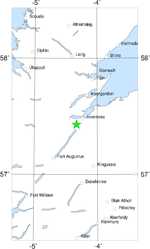

The largest and severest of the known Inverness earthquakes. It caused considerable damage in Inverness, and would have caused many injuries but for the time of day, when the streets were empty. The epicentre was probably SW of Inverness itself. The felt area covers almost all of Scotland; but no damage is reported from anywhere other than Inverness.
The principal aftershock was felt as far away as Aberdeen and Montrose, and is thus also included in the catalogue. Other aftershocks continued until November 1818.
Sources: Musson et al (1984c).