Summary
| DATE | 17/02/1927 |
| ORIGIN TIME | 23:17:00 UTC |
| LOCATION | 49.170 -1.620 |
| DEPTH | 22.0 km |
| MAGNITUDE | 5.4 ML |
| LOCALITY | CHANNEL ISLANDS |
| DATE | 17/02/1927 |
| ORIGIN TIME | 23:17:00 UTC |
| LOCATION | 49.170 -1.620 |
| DEPTH | 22.0 km |
| MAGNITUDE | 5.4 ML |
| LOCALITY | CHANNEL ISLANDS |
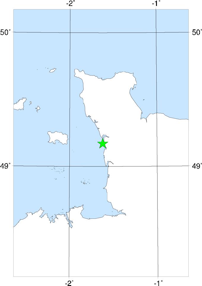

The epicentre of this earthquake appears to be the same as that of the 30 July 1926 event some 6� months previously - E of Jersey, near the W coast of Cotentin, France. The magnitude was slightly smaller and the maximum intensity certainly less. There was very little damage reported in Jersey, mostly confined to plaster and in many cases probably exploiting weaknesses caused by the 30 July 1926 event. The earthquake was felt at low intensities along the S coast of England from Falmouth, Cornwall, to Worthing, Sussex, and also slightly in London and Newbury, Berks. The limits of perceptibility in France seem to be Lisieux in the E and Lorient in the SW.
As with the 27 December 1896 Hereford earthquake, something like a meteor was observed at the same time as the earthquake.
Sources: Mourant (1931), Ambraseys (1985), instrumental.