Summary
| DATE | 09/02/1958 |
| ORIGIN TIME | 23:21:00 UTC |
| LOCATION | 53.750 1.010 |
| DEPTH | 16.0 km |
| MAGNITUDE | 5.1 ML |
| LOCALITY | NORTH SEA |
| DATE | 09/02/1958 |
| ORIGIN TIME | 23:21:00 UTC |
| LOCATION | 53.750 1.010 |
| DEPTH | 16.0 km |
| MAGNITUDE | 5.1 ML |
| LOCALITY | NORTH SEA |
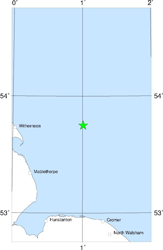

This earthquake was felt over much of eastern England, mostly south of the Humber but reportedly as far north as North Shields. It was felt inland at least as far as Nottingham, and south as far as Elmstead (near Colchester). There was probably no damage (a wall falling at Lincoln may have fallen because of heavy rain rather than the earthquake) - the most severe effects reported were flower pots upset at Lincoln and Peterborough and alarm at Hunstanton. This earthquake is believed to have been felt by members of the Royal Family, who were staying at Sandringham at the time. The epicentre was off the Lincolnshire coast, possibly similar to that of the 23 August 1750 earthquake.
Sources: BGS material, instrumental.